home
***
CD-ROM
|
disk
|
FTP
|
other
***
search
/
Digital Atlas of Idaho
/
Digital Atlas of Idaho.iso
/
hydr
/
snakervr
/
imgs
/
abamf.jpg
next >
Joint Photographic Experts Group Image
|
2002-03-01
|
29KB
|
450x381
|
16-bit (47,498 colors)
Labels:
text
|
map
|
diagram
OCR:
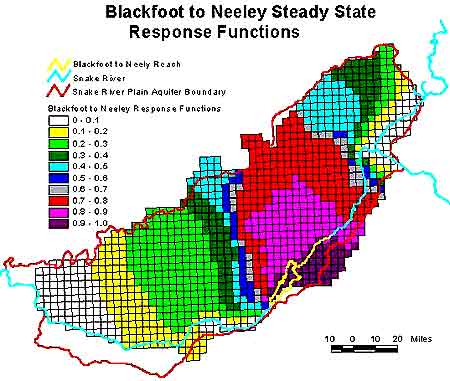
Blackfoot to Neeley Steady State Response Functions Blackfoot to Neely Reach Snake River Snake River Plain Aquifer Boundary Blackfoot to Neeley Response Functions 0 . 0.1 0.1 . 0.2 0.2 - 0.3 0.3 . 0.4 0.4 . 0.5 0.5 - 0.6 0.6 - 0.7 0.7 - 0.8 0.8 - 0.9 0.9 . 1.0 10 0 10 20 Miles